 02 8319 2266 from Australia
 416-628-3473 from Canada
 04 889 4515 from New Zealand
 646-757-1102 from the USA


 Lofoten Islands
You are here: Alpine Exploratory
> Walking guide
> The Lofoten Islands: Walking guide
The Lofoten Islands: Walking guide
Bare facts
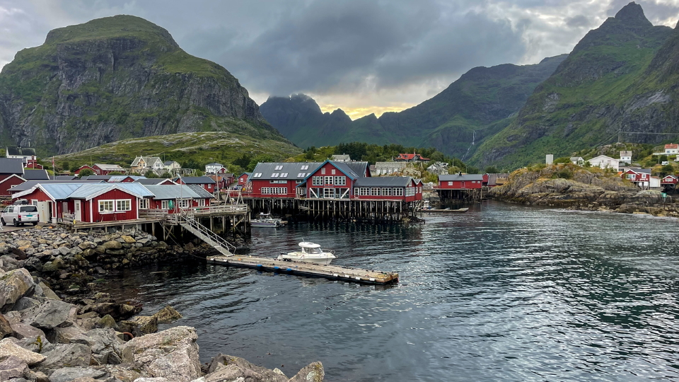
The Lofoten Islands is a hiking trip created by Alpine Exploratory to explore this well-known island chain in the North of Norway. Our trip runs for 7 days and 8 nights, and stays in three bases: Svolvær, Leknes and Å.
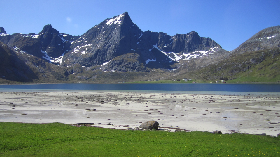
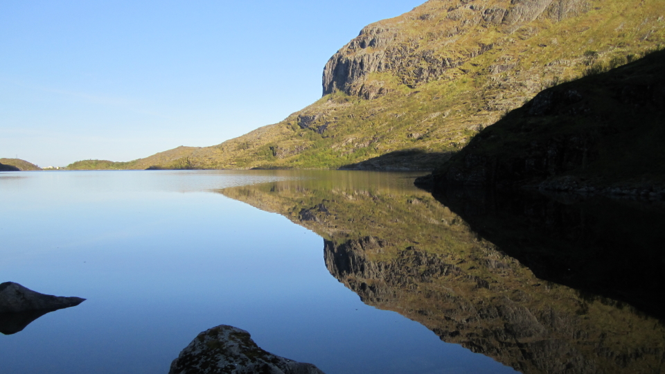
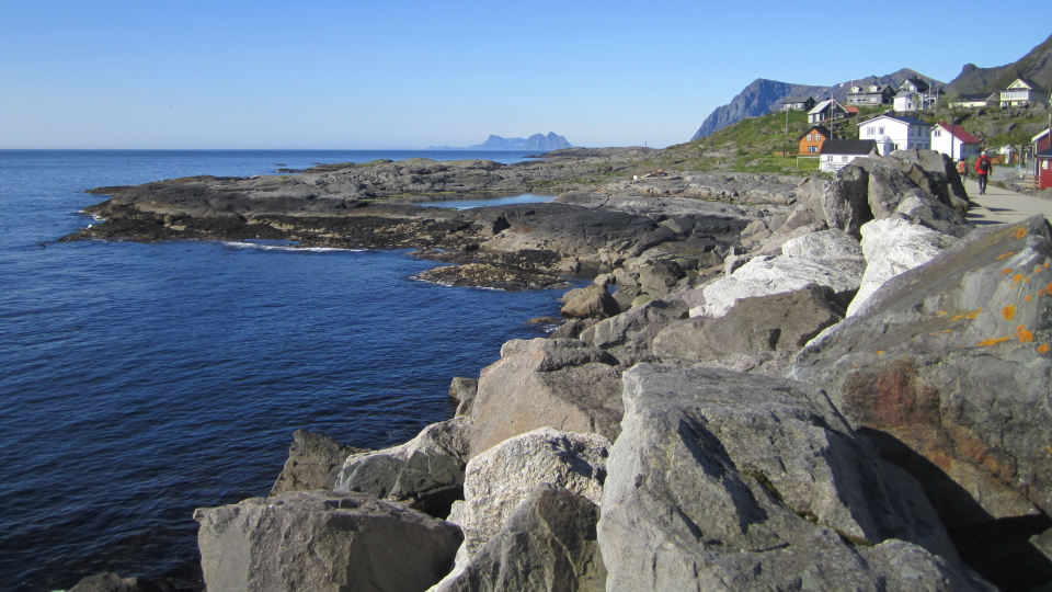
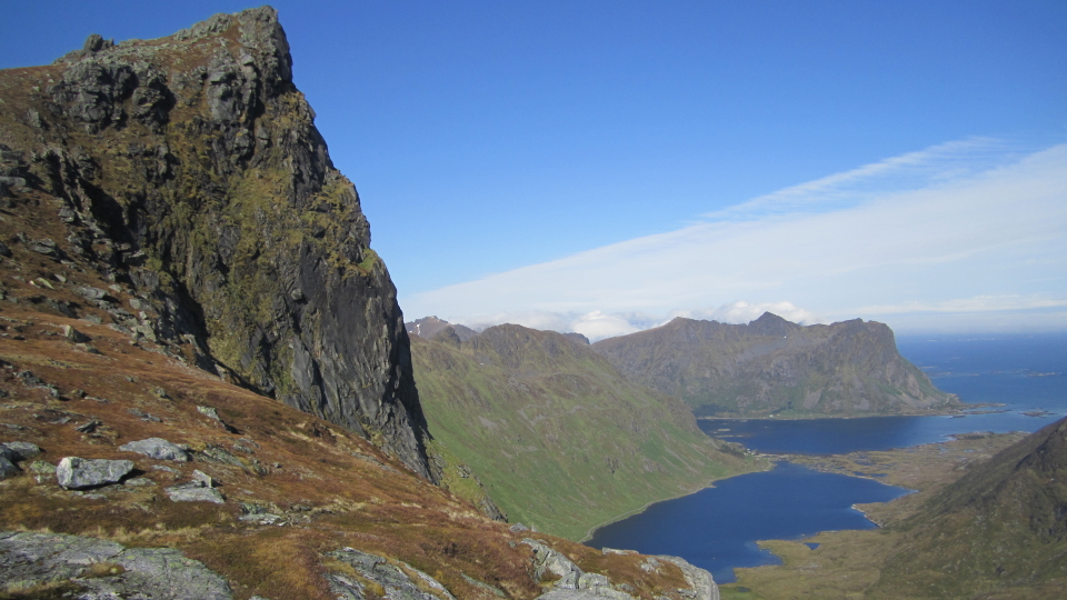
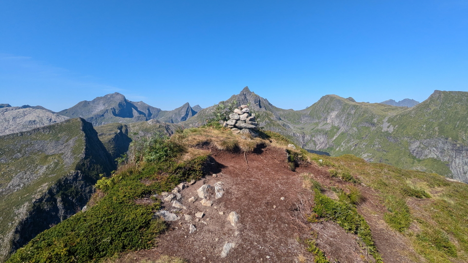
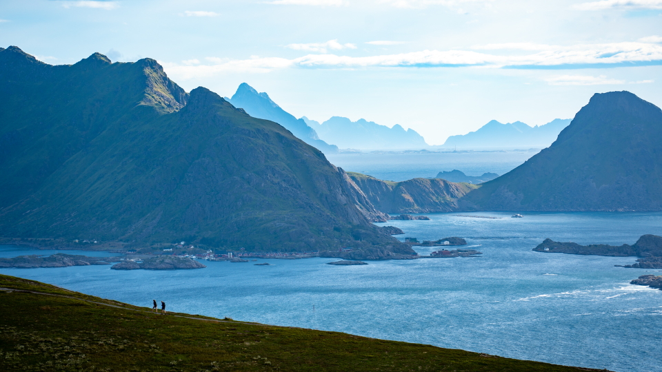
The highest point reached on the whole Lofoten Islands route is the ridge of Blåtinden at 621m (2,037ft). As follows the Lofoten topography, which is essentially islands rising from the sea, many of our walks start from sea level, and overall this is a strenuous trip rewarded by special views.
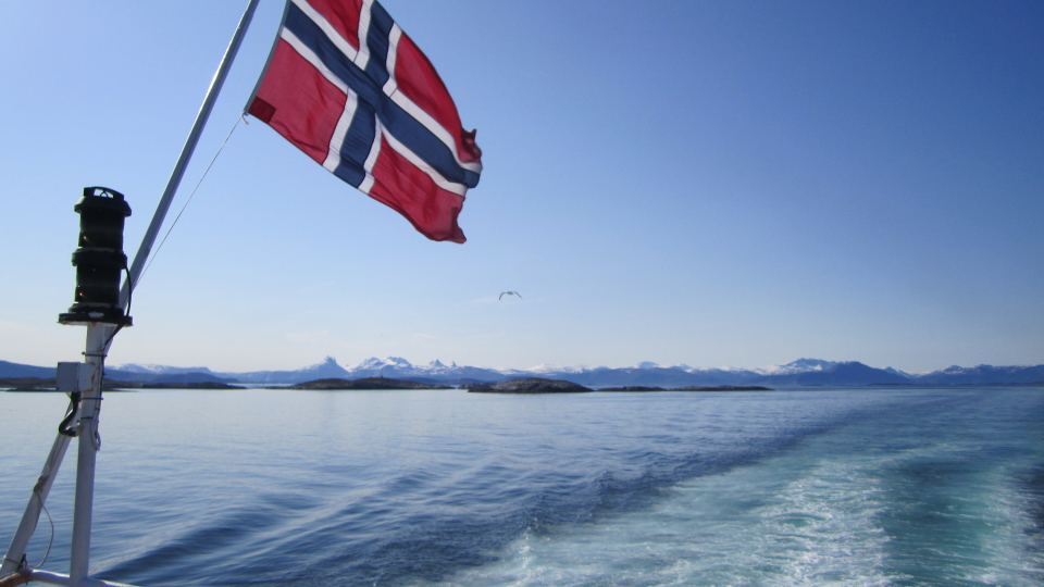
Visitors to Lofoten fly to Bodø and take the ferry to Svolvær. It is also possible to fly directly into Leknes from Bodø, or to fly Narvik on the mainland (Evenes airport), and take the bus to the islands. Bodø, and Narvik airports have flights from Oslo.
The Arctic Circle
The Arctic Circle is defined as the lowest latitude at which the sun does not set for at least one night in Summer, and does not rise for at least one night in Winter.
In Svolvær, Lofoten capital, between late July and the middle of August, the sun stays up in the sky all day round. Lofoten is well within the Arctic Circle, and many travellers, coming from the direction of Narvik on the Norwegian mainland, will experience Arctic Circle life before they reach Lofoten. Bodø is also within the Arctic Circle and is the main ferry port for ferries to the islands.
It is a particular experience to open your curtains at midnight and find it broad daylight. Other than this, the Summer light makes Northern Norway a lovely place to visit.
Languages and names
The Lofoten islands exist entirely within Norway. The language is Norwegian. A very high standard of English is maintained by locals, such that to get about as an English-speaker is no difficulty at all.
Grading
The Lofoten Islands is a trip towards the upper reaches of difficulty, being a Purple grade within the Alpine Exploratory system. When we first visited Lofoten, we wondered about adding a new scale of difficulty, that of 'adaptability if logistics go wrong'. That is, a bus might not turn up, or the weather might be impossible one day. In practice we use our standard difficulty grades (Purple here) in part as a proxy for this putative scale.
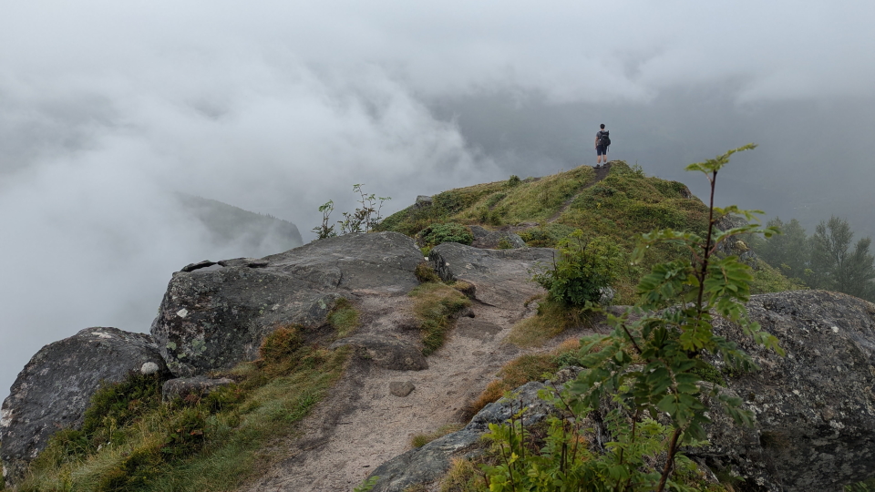
Certainly, some of the walking (as can be seen by the photos on this page) is at a level of steepness and with drops to the side, that fits within our highest grade. We feel that the Lofoten will suit, and hopefully attract, those with solid experience of travel and walking.
When to go?
Our Lofoten season runs from the start of July to the end of August. Essentially, this is the high Summer in Europe and specifically Norway, with the earlier finish than our Alpine trips (August rather than September) set because of the earlier finish of the season's long-distance Norwegian buses.
It is notoriously hard to predict the good weather in Lofoten. Some days are good and some days are bad!
Where to stay
The hotels on our Lofoten Islands trip are good hotels, by the high standards of Norway.
When we first began to consider Lofoten, we thought about a linear trek, point-to-point. This would have involved staying in various different places. Perhaps the linear nature of Lofoten itself, as a chain of islands, led us to seek a linear trek. However, we found such a scheme tricky, because of the sparsity of settlement here: to walk point-to-point across Lofoten would mean too many nights with buses to accommodation, and the buses in Lofoten are not perfect. They are closer to perfection than on some other island chains, but still they lack too much.
Instead, therefore, we looked to a small number of bases, with the limited bus travel that is needed to reach the next base. This gives a flavour of the islands that staying in one place would not.
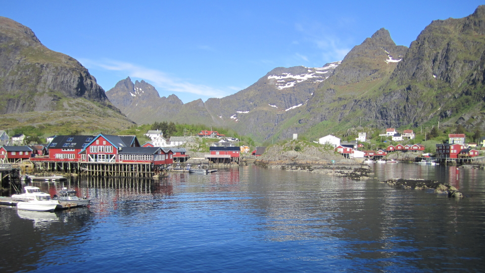
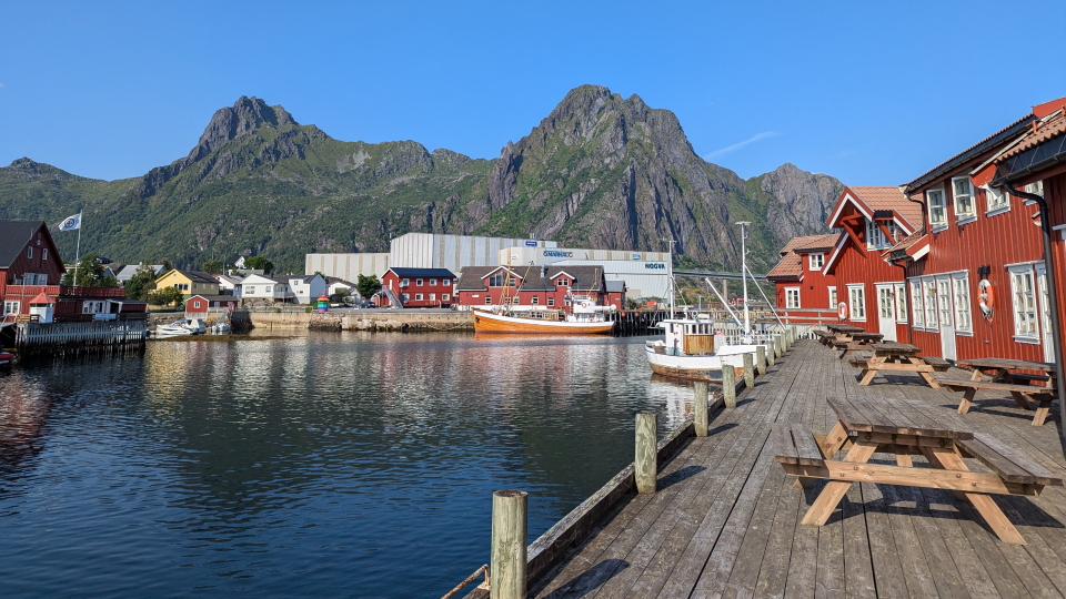
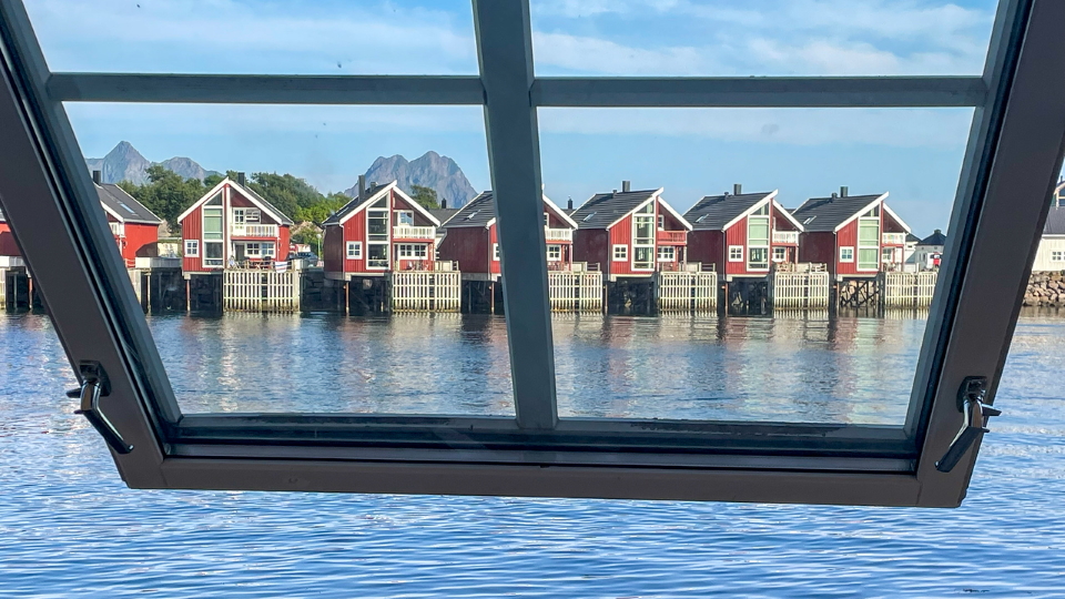
Svolvær as the biggest town on Lofoten has the biggest choice of hotels and offers us plenty, and a sweet harbourside walk in the evenings. Leknes is a quiet town and a base for the Southern islands, and Å is the very far point of the islands and, while small, delightful with its fishing heritage.
City breaks after trekking
Our Lofoten Islands holidays come with notes on the following cities, in your info pack:
 Bergen in Norway
Bodø in Norway
Kristiansand in Norway
Oslo in Norway
Stavanger in Norway
Trondheim in Norway
 City breaks after hiking in the Alps
The Lofoten Islands: Our route
Route 1: Tjeldbergtinden circuit
This walk is a great introduction to walking in Lofoten and makes for a great first stage. Most of the walking is on straightforward tracks and paths, but there are also short sections of rocky terrain and steps nearer the top of Tjeldbergtinden (367m or 1,204ft). These sections represent the norm when it comes to hiking in this part of Norway, and they require care and attention. Enjoy the views back into Svolvær from the higher ground.
Stage 2: Tuva circuit
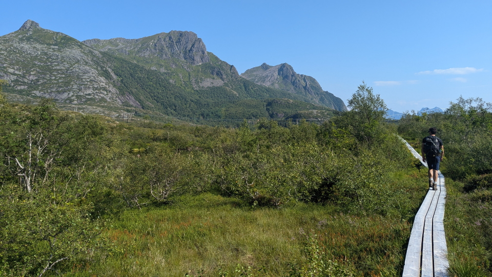
Today's walk takes us from the centre of Svolvær to the summit of Tuva at 477m (1,565ft), and then down again via the steep slabs. We finish the hike with a loop around Gronnasvatnet lake on the boardwalks. The terrain can be boggy during the initial ascent, and then rocky as we near the summit. Take care on the slabs during the descent, particularly in wet weather!
If you'd prefer a shorter day, you can skip the Tuva summit and just do the boardwalk around the lake.
Stage 3: Djevelporten and Fløya Ridge
This popular day-hike is one of the most well-marked trails on the Lofoten islands with regular signposts and blue-white markers showing the way. On your way up to the Fløya ridge, you'll pass the famous floating rock known as the Djevelporten (Devil's Gate). For a popular hike, the terrain is very steep, rocky and muddy so despite the short distance, the going can be slow.
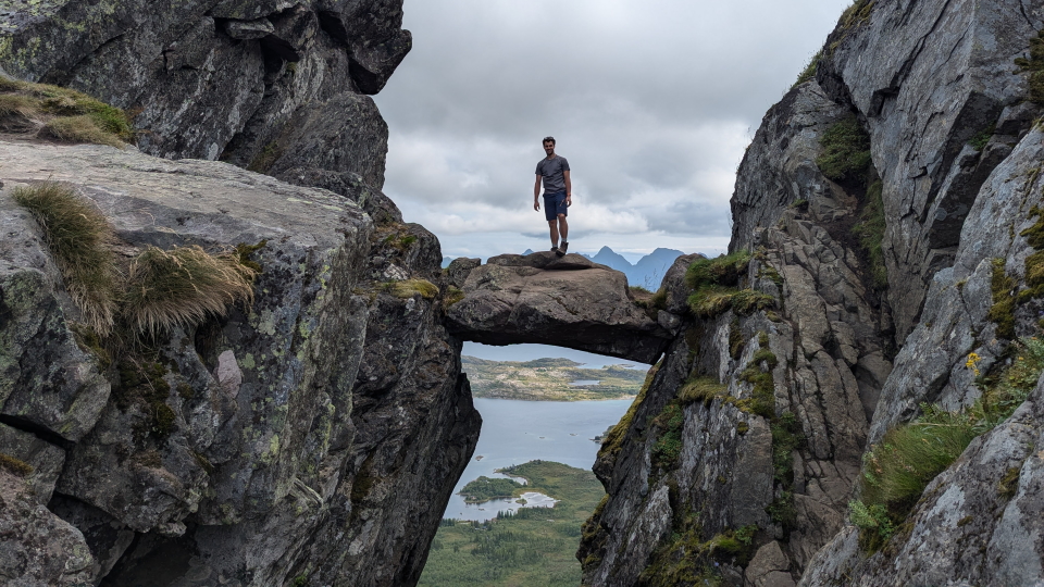
 The famous floating rock of the Djevelporten (Devil's Gate), Lofoten, with a hiker on top
 Lofoten Islands
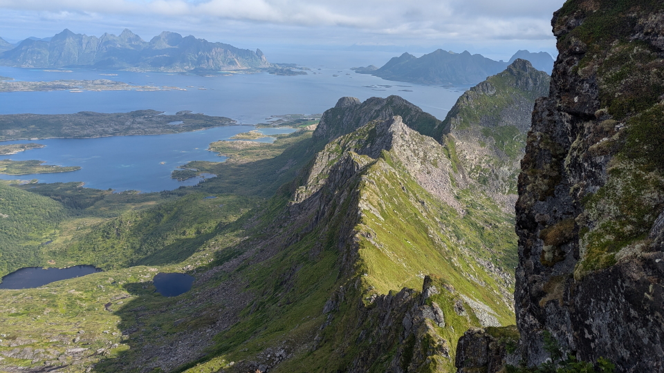
Stage 4: The Three Ridges (Fløya, Blåtinden and Tuva)
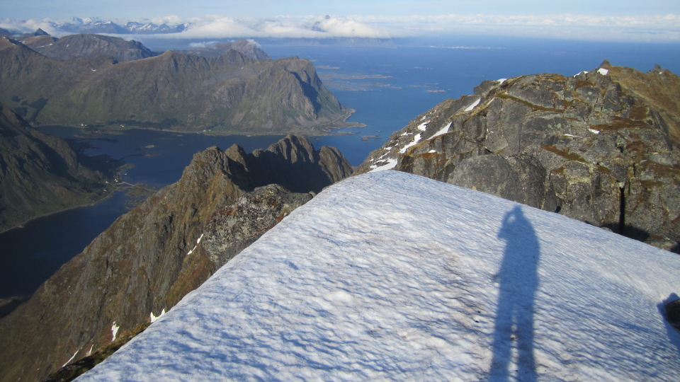
This Routecard combines stages 2 and 3 to make a more challenging circuit ticking off the 3 ridges that make up the back-drop of Svolvær. This hike includes the ascent to Blåtinden ridge following a narrow and faint path. The walking is steep and it's important to stay focused on the navigation. In clear weather the panoramic views from the ridges make the climb well worth it and it feels very satisfying leaving the crowds behind on the way up to Blåtinden.
As an important note, we say to avoid the actual summits of Fløya and Blåtinden. These are exposed vertical scrambles which are outside Alpine Exploratory's grading remit.
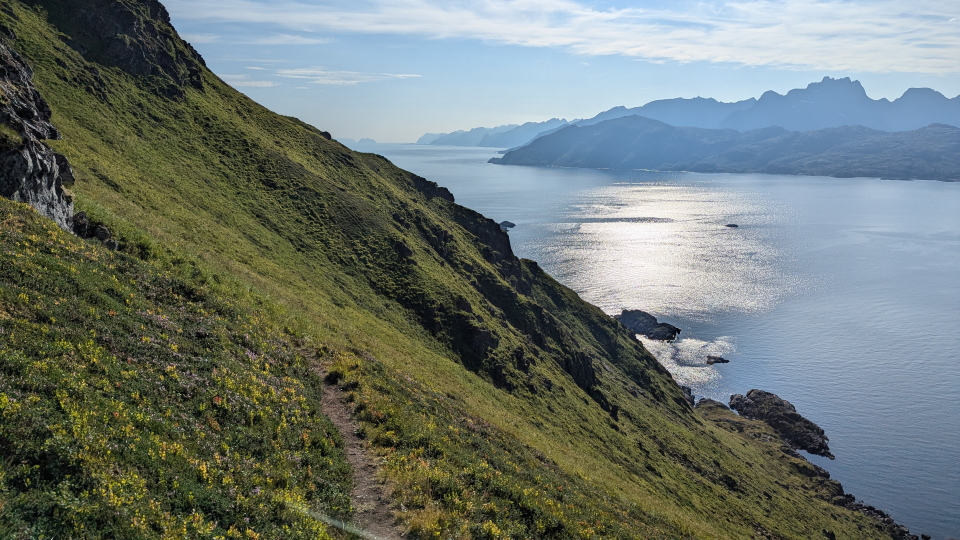
Route 5: Ballstad circuit
After a short bus ride to Ballstad, this hike mixes coastal and Alpine landscapes throughout. The circuit starts with steep steps, and once up high, you'll have access to three summits: Brurstolen (270m), Nonstinden (459m) and Munkan (493m). Despite the low altitude, the views onto the surrounding peaks, the labyrinth of islands and turquoise waters below make it an excellent day hike.
As an important note, the Ballstad circuit does not take place in the village of Ballstad itself. Instead it takes place in the Ballstadheia hills.
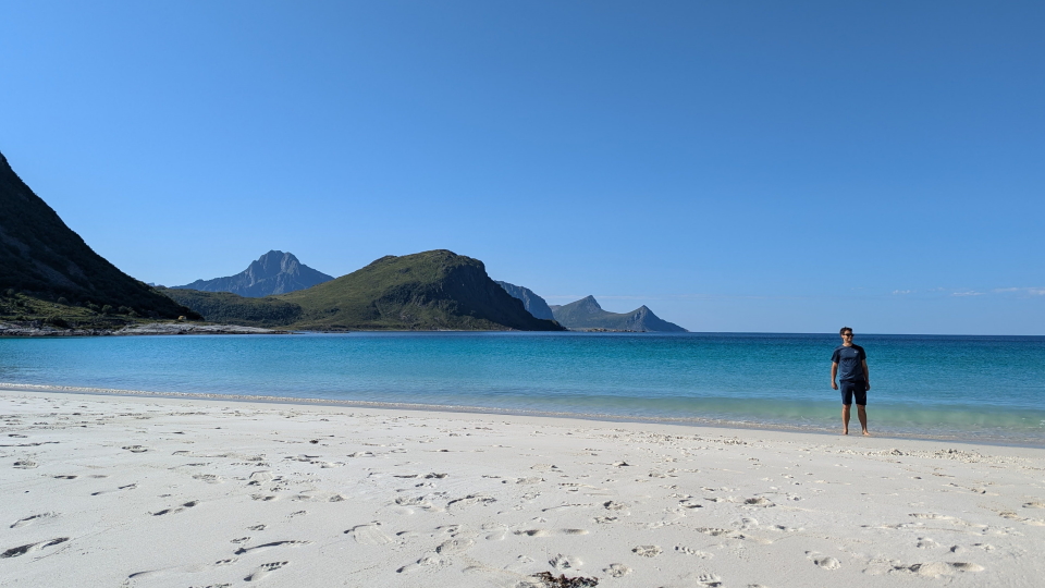
Stage 6: Mannen and Haukland beach
This stage is an easier hike starting at the popular tourist spot of Haukland beach. The white sandy beaches of Haukland and Vik beach attract tourists from around the world, making the car park and visitor centre a busy place to be. On this hike we escape the crowds by heading to Mannen summit (400m or 1,312ft) and Uttakleiv beach for a slightly quieter experience. We think the views and beaches make the crowds worth it, particularly on a sunny day.
Stage 7: Guratinden & Bulitinden
This lesser known hiking trail avoids the crowds to the twin peaks of Guratinden (581m or 1,906ft) & Bulitinden (557m or 1,827ft). This is a straightforward path through dwarf woodland, and then up onto rockier ground by the peaks. There are some stepping stones to cross over the stream coming into Ramsvika so we don't recommend this hike after heavy rain.
Stage 8: Gylltinden and Merraflestinden
We like to describe this hike as our very own version of the popular Reinebringen (without the crowds!). It takes place on the other side of the Djupfjorden with similar views from both summits. The Gylltinden is a steep, rocky and exposed climb so we add this as an optional ascent, at our Black grade. The ascent to Merraflestinden is straightforward and a nice place to stop for lunch or a snack! (If Gylltinden is skipped, today's grade is reduced to Purple.)
Hike the Lofoten Islands with Alpine Exploratory
Alpine Exploratory offers one self-guided option in the Lofoten islands. As well as this, we have organised the Lofoten in the guided style; please contact us to talk about a private guided trip, if this appeals.
Our self-guided holidays give you what you need to complete the route under your own steam. We book your accommodation in a mix of huts and hotels and we give you our detailed Routecards, the local maps, and lots of notes. Importantly we will advise on the ideal schedule and accommodation to suit your approach to the Lofoten islands.
Please ask us any time for more details. Please feel free to describe your walking experience and preferences, and we'll suggest which trek you might enjoy most.
  Lofoten Islands enquiry form
|


 Alpine Exploratory


