 02 8319 2266 from Australia
 416-628-3473 from Canada
 04 889 4515 from New Zealand
 646-757-1102 from the USA


 Alta Via 9
You are here: Alpine Exploratory
> Walking guides
> The Alta Via 9: Walking guide
The Alta Via 9: Walking guide
Bare facts
The Alta Via 9 is a walking trail through the Italian Dolomites, for 134km (83 miles) from Bolzano in the West to San Candido in the East.
The AV9 is unusual among the 10 Alte Vie in that it traverses the Dolomites from West to East, rather than North to South.
The highest point reached on our standard route is Antersas (2,907m or 9,530ft) which is a minor summit on the side of Piz Boè and on the way to Rifugio Boè. As an optional side-trip, hikers can climb to the famous Piz Boè which is 3,152m (10,430ft). The height gain on the whole AV9 route is around 8,800m (28,870ft).
Trekkers typically take 11 days to complete the hike, plus one rest day.
Trips
At Alpine Exploratory we offer the following holidays based on our Alta Via 9 research:
 Dolomites Alta Via 9
Dolomites Alta Via 9 (Guided)
Dolomites Alta Via 9 East
Best bits
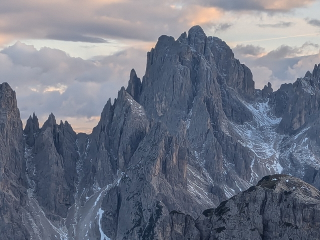
The AV9 takes a grand route from West to East across the Italian Dolomites, passing the AV2 and AV1 along its way. From a start at San Cipriano which is a village outside Bolzano, we take two days to reach the Sella pass, a notable spot in the Dolomites with mountain walls above.
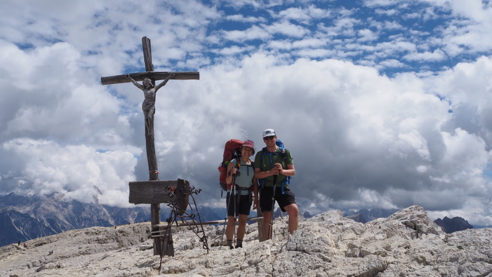
Then, Piz Boè is in sight, the summit itself an optional detour, and a superb mountain summit. After this, we stay at Passo Campolongo near Corvara, a fabulous Dolomites town, and (familiar to AV1 people) the Passo Falzarego and Rifugio Dibona. After these, Cortina itself!
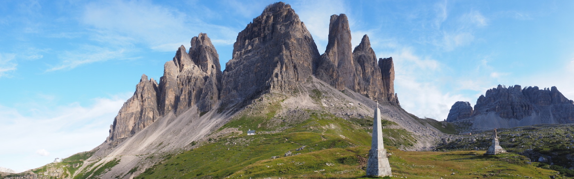
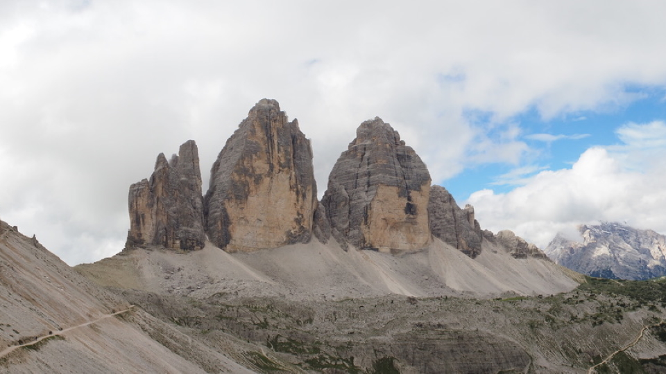
Leaving Cortina towards the East, we make for the famous Tre Cime (Drei Zinnen or Three Heads), a trio of rock towers. Onwards, to San Candido which is a lovely town on the Val Pusteria train line back to Fortezza and thence Innsbruck.
Languages
Alta Via None is the full title of the AV9, in Italian. Translated, it simply means High Route Nine. German is a second language at the start of the AV9, in Bolzano, which is a town called Bozen in the German. The Alta Via 9 goes through German and Italian speaking areas, however hikers who speak only English get by just fine.
Is it for me?
The joy of trekking
The Alta Via 9 has some days that are at the hardest end of our trips (Stage 4 is graded Black) and it also includes some easier days, making it quite varied.
There is great satisfaction in completing stages of a long-distance trek. There might be times when the climb seems too much effort, and when you encounter bad weather; at such times the goal keeps you going. Equally there should be days when you feel all-powerful, tackling the mountain trails as if they were paths in the park!
One of the best feelings on trek can be nearing the end of a stage, once you're well into the walk, knowing that you've ticked off another leg of the quest. At such points you've also got an evening in a new village to look forward to. Travelling in a self-sufficient manner through the charming terrain of the AV9, this all makes for a thoroughly enjoyable and satisfying holiday.
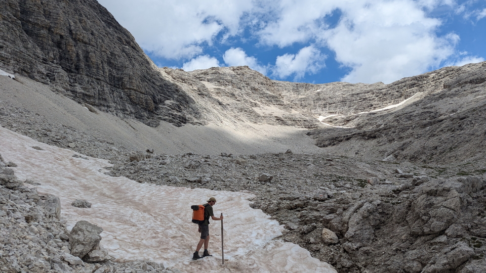
 On the AV9, former Alpine Exploratory team member Dan Needham in the ascent of Piz Boè with July snow
 Alta Via 9
The lie of the land
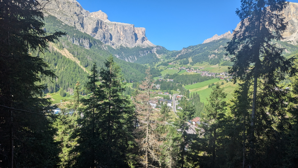
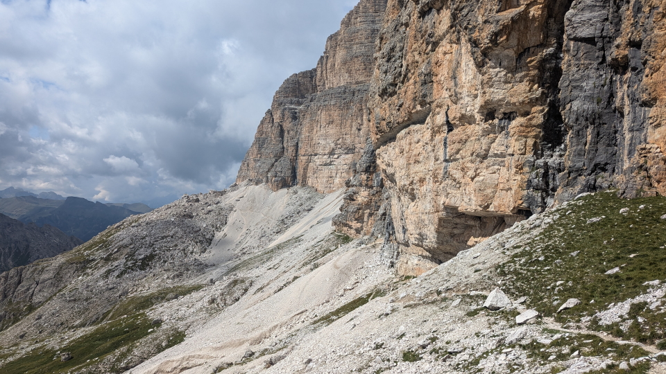
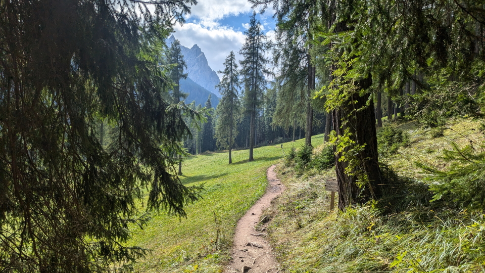
The Dolomites in Italy are part of the Southern Limestone Alps and are characterised by rugged pinnacles, towering cliffs and distinctive rock formations. The terrain is generally steeper and rockier than other areas of the Alps. The region is comprised of groups of peaks, divided by picturesque valleys and meadows. The Alta Via 9 route crosses between groups combining high rocky trails, scree paths traversing below cliffs, and more gentle sections through picturesque meadows.
The Alta Via 9 uses a mix of existing paths. On some of these paths you’re likely to find yourself alone on the trail; other paths are popular with day hikers. For example, Stage 2 of the AV9 follows the Friedrich-August-Trail and Stage 10 passes the famous Tre Cime di Lavaredo; both of these are popular day hikes in their own right. Stage 6 overlaps in part with a section of the Alta Via 1 above Cortina, which makes this stretch busier too. Stage 4 and Stage 9, on the other hand, make use of paths which are much less well trodden, and you might not meet many other hikers in these areas.
Can I manage it?
The AV9 is manageable for fit mountain walkers who are happy to walk for between 5h and 8h per day along a long-distance trail. It will greatly help your enjoyment of the trek to arrive fit at the start, used to walks of similar distance and height gain to those that you are about to face.
The first stage of the AV9, which as can be imagined seeks to climb into the Dolomites, involves an unusual amount of ascent. From San Cipriano, our first day has 1,560m of ascent, which is more than the following days. The most ascent on any subsequent day is the 1,050m on Stage 9 to Rifugio Auronzo.
The spacing of huts determine the distances each day, of course, and we can book many variations on our schedules according to how our clients want to approach the AV9.
What's it like underfoot?
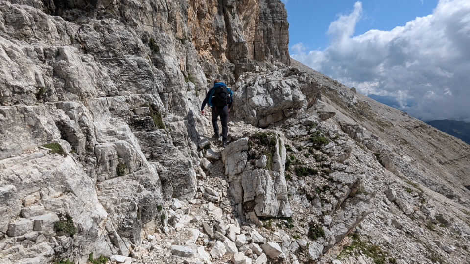
Underfoot you will experience a variety of tracks and trails on the AV9. Standardly the mountainous sections run on single-track paths that can be rocky in places, sometimes with steps but mostly just the bare earth. Tracks are also common - perhaps gravel forest roads, ski pistes, or rough tracks for vehicles over agricultural land. There are some sections of country lanes. There are some sections on roads, most noticeably when leaving Passo Sella to reach the ascent to Rifugio Boè.
Is it technically difficult?
Our Alta Via 9 route is first and foremost a walk – there are no sections of via ferrata, and the route doesn’t cross any glaciers. We take 2 variant routes to avoid sections of via ferrata: these are a route along the south of the Sella group, to avoid via ferrata sections over the top, and a lower route between Lake Misurina and Rifugio Auronzo to avoid via ferrata on the higher route.
There are however some sections where the path crosses rocky and steep ground, plus sections with metal cables as handrails over Alpine walking terrain. Some stages cross open, unforgiving terrain without easy escape routes: full days of mountain walking calling for self-reliance especially in wet weather with bad visibility.
(An option on the AV9 would be to add a rest day in Corvara, which is one of the centres for via ferrata in the Dolomites, and engage a local guide... or for those used to it, to tackle vie ferrate by themselves. Kit will be needed! Alpine Exporatory does not offer or vouch for any via ferrata routes, or climbing, but we are glad to advise in general terms on what might be out there.)
There are some sections of the AV9 where the path crosses rocky, loose and steep ground, plus sections with metal cables as handrails over Alpine walking terrain. Some stages cross open, unforgiving terrain without easy escape routes: full days of mountain walking, calling for self-reliance especially in wet weather with bad visibility.
Are the routes obvious?
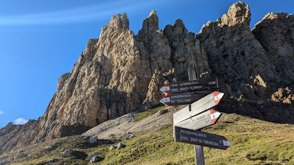
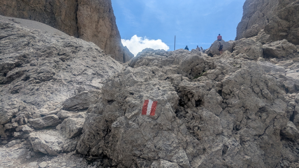
The trails in the Dolomites are generally well-marked with signposts and painted waymarkers, making navigation relatively straightforward. However, the route is never signposted as the Alta Via 9. Sign posts with names of surrounding huts and villages are common, as are painted red and white flashes on the rocks – sometimes with the trail number painted on. Some paths and tracks that have been adopted by the Alta Via 9 are less well used by general walkers, and in these cases waymarking can be sparser.
Unseasonal weather
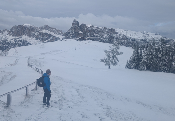
The typical Summer's day in the Alps brings hot sun, perhaps with occasional rain or afternoon storms. Fresh snowfall can occur each Summer. Most often, these leave a coating of an inch or two, just on higher passes, and these disappear in a day or two. However, sometimes the snow stays for longer periods and is deeper. While the AV9 should be approached as a Summer Alpine trek, with snow quite unlikely, it is wise to know that snow can fall even in Summer.
When to go?
Our Alta Via 9 season runs from mid-July to mid-September. This short season is imposed by the weather: the chance of late-Spring snow patches remaining into early July across the higher passes, and the chance of the weather deteriorating into late September. Because we can't predict the weather for the coming Summer, we have to set these dates in advance.
Where to stay
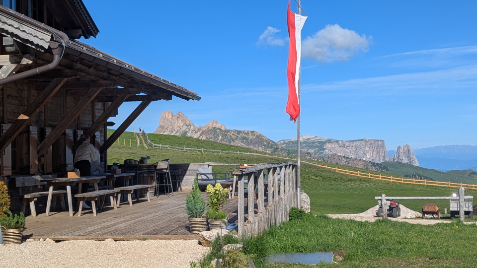
The AV9's hut-to-hut accommodation is an enjoyable part of the route. Unlike the AV1, which is solidly in huts once you're up high, the AV9 mixes huts and hotels in a fairly consisent pattern. We find more luxurious hotels in Bolzano, Cortina and San Candido, and we find some curiously comfortable huts along the way, which are far from huts as many of us would understand the term!
Much of the accommodation is family-run, even in larger towns such as Bolzano, Cortina and San Candido. It's fun to be able to book a rest day in Corvara as standard, as a rest day befits this slightly longer hike whereas it doesn't really on the AV1. Corvara is a fabulous place, nestled amongst the mountains and with plenty of cable car options to explore more.
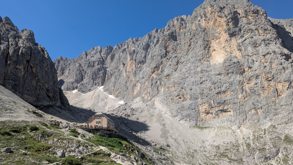
The Italian huts along the Alta Via 9 are cosy and welcoming, catering for a large number of people enjoying the hiking in the Dolomites. A mix of private rooms and dormitories are common in the huts. (We will advise on the sleeping arrangements according to your particular schedule.) The Italian food served in the huts is a highlight and well deserved after a day in the hills!
City breaks after trekking
Our Alta Via 9 holidays come with notes on the following cities, in your info pack:
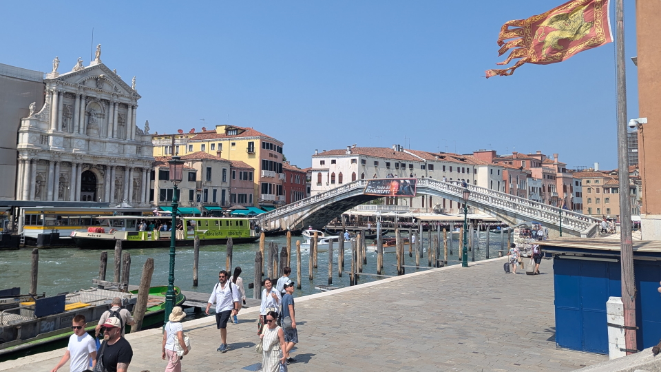
 Venice in Italy
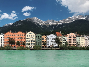
Innsbruck in Austria
Munich in Germany
City breaks after hiking in the Alps
The Alta Via 9 in context
The AV9 compared to treks in the UK
Compared to most treks in the UK, the AV9 has lower daily distances but with higher amounts of ascent and descent. The West Highland Way in Scotland, for example, has much longer stages but walks across much easier terrain with much less ascent. Of course, the altitude is higher throughout on the AV9, as it is on most Alpine treks. Perhaps most important of all is the terrain, where trekking in the UK - as opposed to some hillwalking - is a lot less rough underfoot and less demanding in balance and dealing with drops to the side.
The AV9 compared to the TMB and the Walker's Haute Route
The AV9 adds a further fascinating option to the classic duo of the Tour du Mont Blanc and Walker's Haute Route. Compared to the TMB, the AV9 has less daily distance and elevation gain. A lot of the AV9's distance runs along good solid and wide tracks, making progress quick and easy... but importantly, the rocky and rough sections when they come are more demanding than those on the TMB. Some settings are bold and mountainous.
Essentially, the Dolomites are convex mountains in profile, as opposed to the concave mountains found elsewhere throughout the world: the classic mountain shape. By this we mean that if you are traversing high up in the Dolomites, the ground below you is likely to be steeper than the ground above. This explains much of the feeling in the Dolomites.
More sections of the AV9 have steep drops to one side or other, or both. The AV9 is a trek in and across the mountains, as opposed to the TMB's gentler terrain set apart from the main massif. The AV9's uphill walking is more spaced out; there are fewer solidly uphill sections taking all morning, for instance. Compared to the Haute Route, the AV9 is less challenging overall, but with some days that some might feel approach the Haute Route's level of terrain and situation.
Comparing our 6 big Alpine treks
The AV9 is a solid cross-country route that combines the delightful Dolomites views of the AV1, at a similar (slightly longer) overall length, and with a similar level of difficulty: not as extreme as our Walker's Haute Route while still containing mountainous and loose situations in which good balance and mountain sense are essential.
The Haute Route is substantially the toughest, suitable only for trekkers with particularly solid experience, balance and fitness.
The Via Alpina includes three rocky cols that approach the Haute Route's level of challenge, though the route as a whole is more forgiving. The Adlerweg is similar in difficulty to the Alta Via 9 but overall a longer trip.
The AV1 is more consistent in its difficulty but is especially demanding of good balance, with steep, rocky and wild situations calling for mountain experience.
The TMB is a superb all-rounder that mixes tough, solid mountain days with gentler ones, allowing trekkers to sample the harder terrain as at the Fenetre d'Arpette (a variant, shared with the Haute Route) while not requiring any extremes.
It's worth noting that each trek has different possible schedules, governing the physical difficulty, and on many days different variants affect the terrain difficulty.
Below we compare the statistics of our 6 big trips in the Alps, being those ones on our books that are longer than one week:

Italy
A week and a half of Alpine trekking from Dobbiaco to Belluno
A week and a half of Alpine trekking from Dobbiaco to Belluno

Distance: About 120km or 75 miles
typically done over 9 stages
Ascent: About 6,650m (22,000ft)
Highest point: Just over 2,750m (9,000ft) and the route spends much time over 2,000m
Terrain: Good mountain paths, some rockier and looser sections, tracks and country lanes
Accommodation: Mostly mountain huts, plus hotels at start and finish
Season: Mid-July to mid-September
Italy
Two weeks of Alpine trekking from Bolzano to San Candido
Two weeks of Alpine trekking from Bolzano to San Candido
Distance: About 134km or 83 miles
typically done over 11 stages
Ascent: About 8,800m (28,870ft)
Highest point: Antersas at 2,907m (9,530ft) near Rifugio Boè, and the route spends much time over 2,000m
Terrain: Good mountain paths, rockier and looser sections, scree and boulders, and tracks
Accommodation: Hut and hotels almost in sequence
Season: Mid-July to mid-September
France, Italy and Switzerland
Two weeks of Alpine trekking in a circuit from the Chamonix valley
Two weeks of Alpine trekking in a circuit from the Chamonix valley

Distance: About 180km or 110 miles
typically done over 11 stages
Ascent: About 10,700m (35,000ft)
Highest point: Just over 2,500m (8,200ft) and the route crosses several passes around 2,500m
Terrain: Good mountain paths, rockier and looser sections, cables and ladders, tracks and country lanes
Accommodation: Hotels, huts and auberges in a varied mix
Season: Early July to mid-September
France and Switzerland
Two weeks of Alpine trekking from Chamonix to Zermatt
Two weeks of Alpine trekking from Chamonix to Zermatt

Distance: About 200km or 125 miles
typically done over 14 stages
Ascent: About 12,900m (42,300ft)
Highest point: Just under 3,000m (9,800ft) and the route crosses several passes over 2,900m
Terrain: Good mountain paths, rocky and loose sections, wild remote cols, cables/ladders, tracks and lanes
Accommodation: Hotels, huts and auberges in a varied mix
Season: Mid-July to mid-September
Austria
Three weeks of Alpine trekking in the Tyrol from St. Johann to St. Anton
Three weeks of Alpine trekking in the Tyrol from St. Johann to St. Anton
Distance: About 387km or 242 miles
typically done over 19 stages
Ascent: About 14,400m (47,240ft)
Highest point: Just over 2,250m (7,380ft) and the route crosses a number of cols above 2,000m
Terrain: Good mountain paths, forest tracks, some rockier and looser sections, tracks and country lanes
Accommodation: Hotels and huts in a varied mix
Season: Early July to mid-September
Switzerland
Three weeks of Alpine trekking across the width of Switzerland
Three weeks of Alpine trekking across the width of Switzerland

Distance: About 349km or 219 miles
typically done over 18 stages
Ascent: About 19,960m (65,485ft)
Highest point: Just over 2,800m (9,180ft) and the route crosses three passes above 2,300m
Terrain: Good mountain paths, rocky and steep cols, grassy cols, tracks and country lanes
Accommodation: Good hotels and no huts (but can be added)
Season: Mid-July to mid-September
Hike the Alta Via 9 with Alpine Exploratory
Alpine Exploratory offers two self-guided options on the AV9 (the full hike and a shorter Eastern sub-section), plus one guided trip. We're also pleased to book shorter or longer sub-sections of the route according to your available dates. Please contact us to discuss options.
Dolomites Alta Via 9
Dolomites Alta Via 9 (Guided)
Dolomites Alta Via 9 East
Our self-guided holidays give you what you need to complete the route under your own steam. We book your accommodation in a mix of huts and hotels and we give you our detailed Routecards, the local maps, and lots of notes. Importantly we will advise on the ideal schedule and accommodation to suit your approach to the AV9.
As well as the full route from Bolzano to San Candido, we offer what we call the Alta Via 9 East (which is between Cortina and San Candido). That route can combine nicely with our Alta Via 1 North (which is between Lago di Braies and Cortina) for a great introduction to the Dolomites. Please ask us!
Our guided trip is similar but gives you the benefit of an Alpine Exploratory leader to show the way.
Please ask us any time for more details. Please feel free to describe your walking experience and preferences, and we'll suggest which trek you might enjoy most.
  Alta Via 9 enquiry form
|


 Alpine Exploratory


