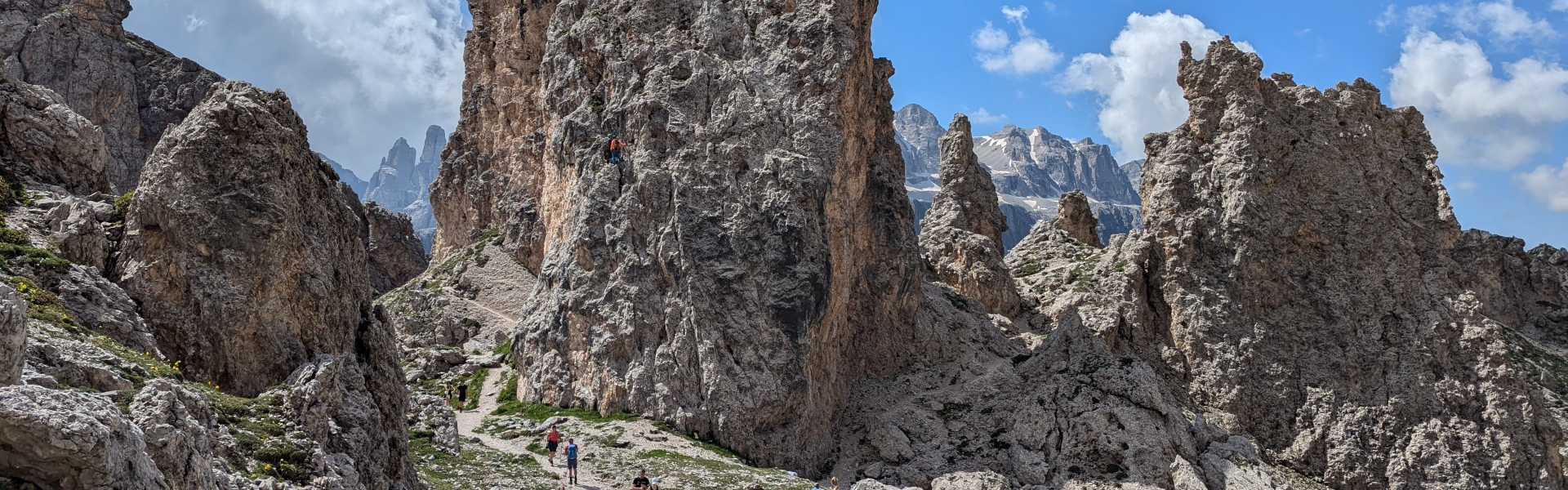
 Alta Via 2: North
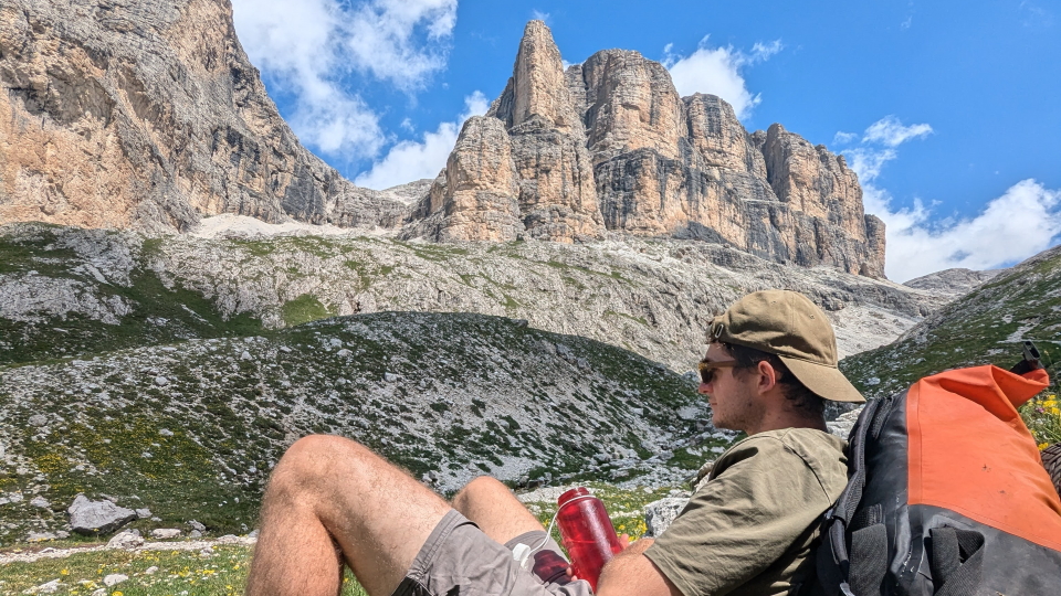
 Former Alpine Exploratory team member Dan with his Alpine Exploratory water bottle
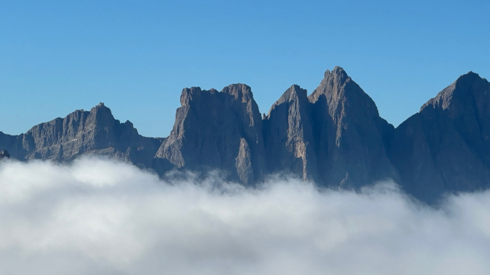
 Alta Via 2: North
 02 8319 2266 from Australia
 416-628-3473 from Canada
 04 889 4515 from New Zealand
 646-757-1102 from the USA
 02 8319 2266 from Australia 416-628-3473 from Canada 04 889 4515 from New Zealand 646-757-1102 from the USA
 Booking from overseas


The Alta Via 2 is a hiking route that goes North to South in the Italian Dolomites, a valley or two to the West of the Alta Via 1. As we'll explain below, Alpine Exploratory offers the Northerly week of the AV2, and it is this 'Alta Via 2: North' that is the subject of this page.
Alpine Exploratory covers the first 7 stages of the AV2. The highest point reached on these 7 stages (our Alta Via 2 North) is 2,908m (9,541ft) at l'Antersass, a minor summit in the Sella Group. We offer the subsequent ascent of Piz Boè (3,152m or 10,341ft) as an optional walk, a detour from our main route.
To reach Brixen at the start of the AV2, we suggest flying (or taking the train) to Munich or Venice. These cities are connected by train over the Brenner Pass, a major crossing point in the Eastern Alps near to the Austrian city of Innsbruck. Brixen is a stop on the Italian side of the Brenner Pass, in the predominantly German-speaking part of Northern Italy. At the end, at Passo San Pellegrino, buses lead onwards to Venice.
Former Alpine Exploratory team member Dan with his Alpine Exploratory water bottle
Alta Via 2: North
The Alta Via 2, Italian, literally means High Route 2 in English. Quite simply, we shorten Alta Via to AV, as in AV2. The AV2 is one of 10 AVs, each making some form of traverse across the Italian Dolomites.
Alpine Exploratory has identified the AV1, the AV2 and the AV9 as the three of the ten AVs that are feasible for the walker who does not want Via Ferrata or otherwise unduly loose and difficult terrain, and who wants a hut or a hotel on each night. On the AV2, we stick to the first week of its roughly two weeks, in order to keep within these limits.
The full Alta Via 2 starts in the North at Brixen (Bressanone in Italian) and finishes in Feltre to the South; our shortened AV2 North trip finishes at Passo San Pellegrino, roughly halfway through the full trail. In the Northern reaches of the AV2, German is the main language spoken; this area of Northern Italy was historically part of the Austrian state of Tirol, ceded to Italy after the First World War. A regional language called Ladin is also spoken in this area, particularly in the valleys around the Sella massif.
Our AV2 is just the Northern week. Indeed, we call it the 'AV2: North' for this reason. Why is that?
When we first contemplated the AV2, having been long-established on the AV1 (since 2012) we looked at each section of the AV2 route with a mind to avoid those bits that were too reliant on via ferrata sections, or that were over too-rough ground: essentially, bits that were too hard.
In fact, on an early visit to the Dolomites in July 2010, Simon walked half a day of the AV2 in a descent route from Rifugio Pisciadù. This was after doing the via ferrata called Tridentina. It felt like a level of difficulty above the AV1.
On our first full trek of the AV2, we identified those AV2 days that we would look at to detour. On our second visit we made most such detours, and concluded that to give a solid week's holiday in one go, and to avoid any silly bus transfers to skip bits, we would simply walk the first week of the AV2 and finish at Passo San Pellegrino. As well as this, we felt that we should seek a less challenging way up onto the Sella plateau from Passo Gardena, and so we would divert from the official AV2 on that day.
Very roughly, we walk the first (Northern) week of the AV2, between Brixen and Passo San Pellegrino, and skip the second (Southern) week. The walking on this Alta Via 2: North is harder overall than the AV1, but not so hard as to be unrealistic for our fit and experienced walkers.
Alpine Exploratory gives the Alta Via 2: North its Black grade. Of our 7 stages, three are Red, two are Purple and two are Black.
Generally speaking, the walking on the AV2 is at the harder end of our trips, harder than the AV1 but not as hard as the Walker's Haute Route. Those days that are Red grade are similar in difficulty to the Tour du Mont Blanc, while the other days are harder, and some substantially so. Some days involve a constant challenge of steep rocks, boulders, and mountainous situations in which a slip would be a big problem.
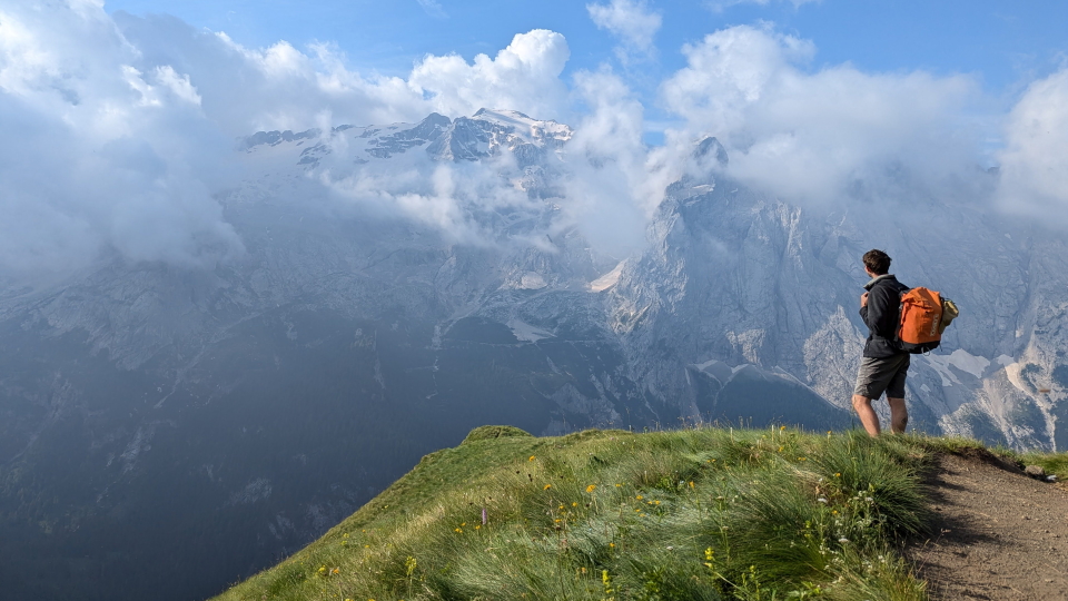
The reward for this, however, is a grand journey through bold, uplifting landscapes - a real treat. There is mountain majesty on the AV1, but there is no doubt that the AV2's mountain majesty is more... majestic.
Our AV2 season follows our normal 'high Alpine' dates of mid-July to mid-September. We start the AV2 in the middle of July as opposed to the start of July, in order to avoid the Spring snow that can remain until the start of July. At the end of the season, we set mid-September to avoid the worsening weather (as well as hut, hotel, shop and cable car closures) that can come in later in September.
Within this short season itself, there are no particular reasons to choose one month (July, August or September) over another. We advise people simply to choose the dates that best suit their diaries. Some hikers prefer July for its longer days and greater presence of mountain flowers - though really, May and June are the times for mountain flowers. Some hikers prefer August, which can often be slightly quieter. Others prefer September - not really a quieter month, but with fewer school-age children.
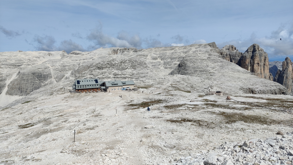
In general, compared to the Alta Via 1, our Alta Via 2: North trip stays a greater number of nights in hotels and fewer nights in huts. The route still generally stays up high in the mountains, with two of our 4 hotels being located at (or near to) the summits of road passes; the hamlet of Malga Ciapela at the end of Stage 6 is the only settlement passed by the trail.
It's great fun that the AV2's start town, Brixen (Bressanone in Italian), is so vibrant and colourful, and has a good choice of hotels. After Brixen, the initial section of the Alta Via 2 is relatively 'hutty', with 3 nights spent up high in the mountains. After this, our route drops to the Sella Pass for a night at a hotel, albeit one in the location where one might expect to find a hut!
The AV2 huts are lovely, enjoying spectacular views and offering delicious and plentiful regional Italian cuisine. Some of the huts not as basic as the word 'hut' might suggest - for example, private rooms are available at two of the huts we usually book, Rifugio Plose and Rifugio Genova - while the more remote shelters of Rifugio Puez and Rifugio Boè make up for their shared rooms and more limited facilities with their wilder, more remote locations.
At Alpine Exploratory we make regular visits to the Alta Via 2, as with all the trails we offer. Please see our Recces page. We are afoot in the Alps! We write a Season Update based on our findings, with details on snow cover and any changes since our last visit to the route, and we send this to all of our customers walking the AV2.
 Recces
Our Alta Via 2 North holidays come with notes on the following cities, in your info pack:
 Milan in Italy
Turin in Italy
Venice in Italy
Verona in Italy
City breaks after hiking in the Alps
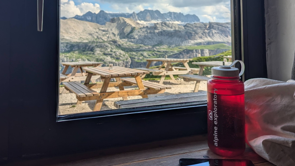 An Alpine Exploratory water bottle in the window at Rifugio Puez, Italian Dolomites
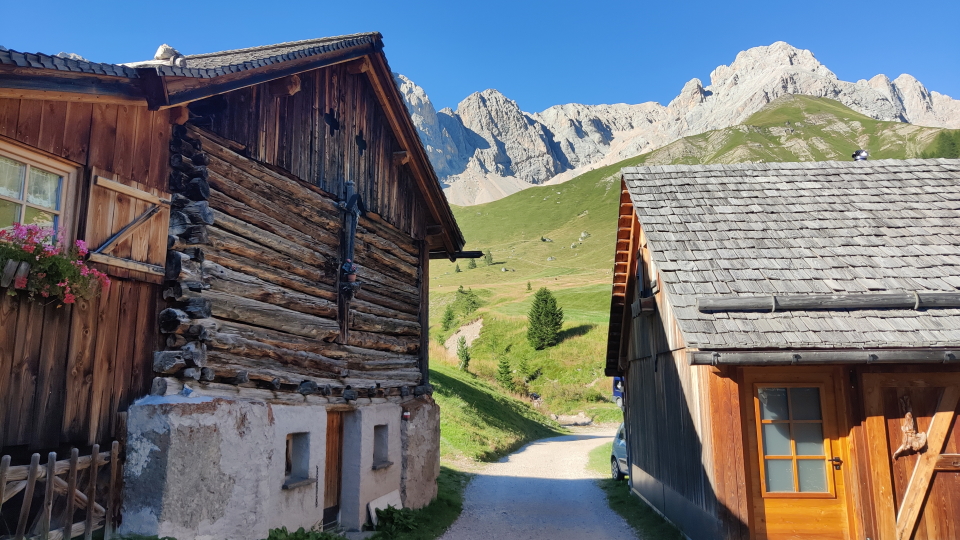
Alta Via 2: North
An Alpine Exploratory water bottle in the window at Rifugio Puez, Italian Dolomites
Alta Via 2: North
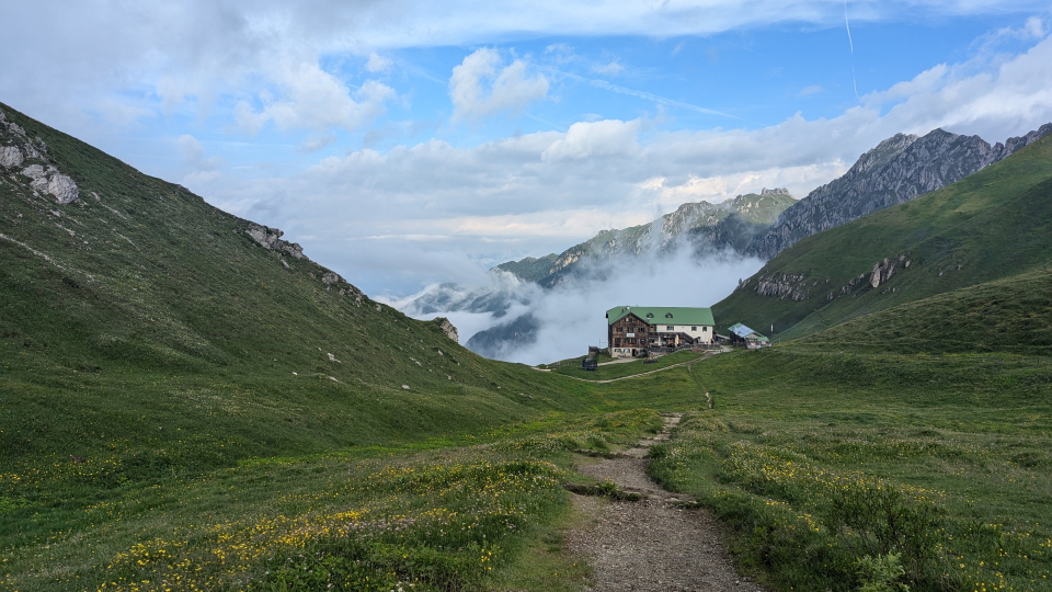
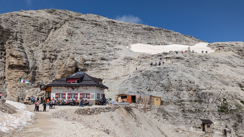
Walking directly from the centre of Brixen, this long and sustained ascent is a challenging way to start the Alta Via 2, particularly with legs that are yet to fully warm up! The terrain underfoot is straightforward throughout, however, and the ascent can be broken down into three distinct sections. Firstly, we climb from Brixen to the village of St. Andrä, on a shelf overlooking the valley. From here, the central section of the ascent leads steeply uphill through trees, but can readily be skipped by a cable car (saving nearly 1,000m of ascent). The final ascent to the hut is across open ground, with panoramic views across the Northern edge of the Dolomites.
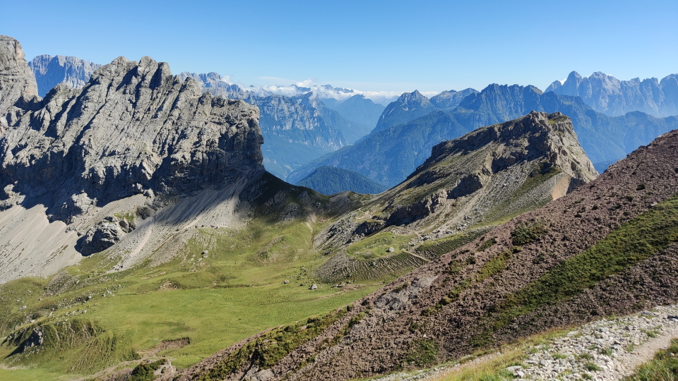
 Views from Rifugio Plose to the surrounding peaks, the Peitlerkofel (far left) and Seceda (centre-right) in view behind. The V-shaped col down and right from the Peitlerkofel is the Forcella del Pütia, crossed by the next stage of the Alta Via 2.
Alta Via 2: North
Views from Rifugio Plose to the surrounding peaks, the Peitlerkofel (far left) and Seceda (centre-right) in view behind. The V-shaped col down and right from the Peitlerkofel is the Forcella del Pütia, crossed by the next stage of the Alta Via 2.
Alta Via 2: North
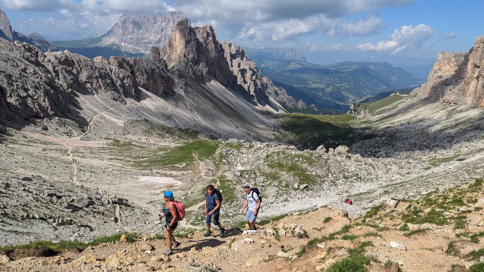
Traversing open slopes below the Plose hut, the trail soon descends in earnest to the road at Passo Rodella. We follow the wooded valley for a short distance before climbing, on a rockier path up up a gully to the Forcella del Pütia, a dramatic viewpoint. Rifugio Genova lies a short distance below the col, surrounded by meadows.
This stage, that links two huts, stays resolutely high in the mountains. The day involves rocky walking among cols and passes, and has three sections with cable handrails, on which we recommend a good grip.
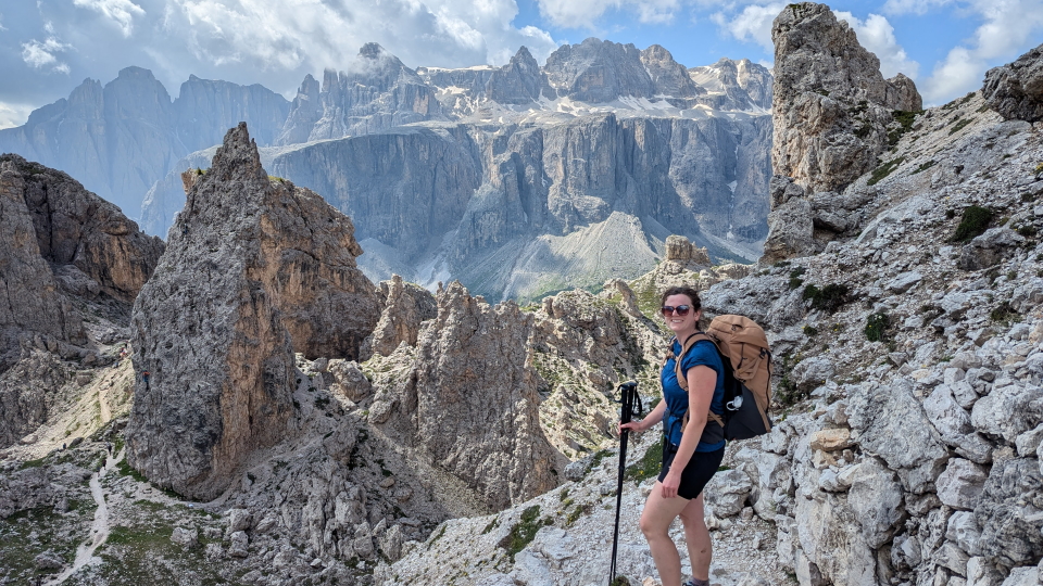
We take a route to the side of the AV2 today, in order to avoid the difficult gully just North of Rifugio Pisciadù (mentioned above). From Rifugio Puez we cross Passo Gardena (a major Dolomite pass, between Corvara in the East and Ortisei in the West). We then take a route away from the AV2 to its West, and aim for Passo Sella (another major Dolomite road pass). The Sella massif is above us to the East, steep-sided and formidable.
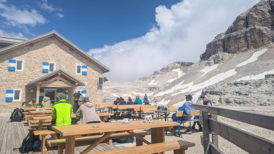
Today we venture onto the Sella plateau and aim for Rifugio Boè which is near Piz Boè. We treat Piz Boè (3,152m or 10,341ft) as an optional ascent from the hut. It is 1km with 280m (919ft) ascent, and of course the same in descent.
This day of intermittent downhill can be helped by taking the Pordoi cable car near the start, which lets us down from the Sella plateau to the road to the South (Passo Pordoi). After Passo Pordoi we are walking to the North of the famous Marmolada.
The Forcella Rossa (2,486m or 8,156ft) provides a clear mid-point of today's last stage, with ascent beforehand and descent afterwards. Passo San Pellegrino, with hotels spread along the road on the pass, is not the pass of water fame: there are multiple Passo San Pellegrinos in Italy, and this is not the one. It is home to a modest ski area, and a bus stop for the West.
Alpine Exploratory offers one self-guided option on the AV2.
Our self-guided holidays give you what you need to complete the route under your own steam. We book your accommodation in a mix of huts and hotels, and we give you our detailed Routecards, the local maps, and lots of notes. Importantly we will advise on the ideal schedule and accommodation to suit your approach to the AV2.
Our guided holidays are the same, except that we substitute maps and Routecards for an Alpine Exploratory leader, and you travel with others intent on the same expedition.
Please ask us any time for more details. Please feel free to describe your walking experience and preferences, and we'll suggest what style of trek you might enjoy most.
Alta Via 2 North enquiry form
|

Alpine Exploratory
Alpine Exploratory is a system of knowledge on the best mountain trekking in our areas, giving clients superb holidays based on this exploration.
About us
HOLIDAYSHike with us in the Alps, Scandinavia, the UK or Ireland. Go self-guided or guided.
Schedule 2026 Holidays: Alps Holidays: Scandinavia Holidays: UK and Ireland Holidays: Guided EXPLORE
We research and interpret the trail to give you the finest walking holiday.
Walking guides Travel Articles About our holidays (FAQs) Photos from trips Recces Responsible travel Equipment Walking grades ABOUT USAlpine Exploratory is a system of knowledge on the best mountain trekking.
About us People The Exploratory System In the pipeline History Join our team AE Store Privacy Policy Terms and Conditions Contact us
 Alpine Exploratory
34 Rose Street North Lane
Edinburgh
EH2 2NP
United Kingdom
 info@alpineexploratory.com
 +44 (0)131 214 1144 Contact us Calendar
 Facebook
 Instagram
