Many of our holidays pass nearby, or even over, points in the hills (summits) that are the highest in their respective countries. It is often possible to visit such points on your trek, and we are glad to explain the ways to reach them.
Please read this page for an introduction to what's where! Please ask us any questions.
Just to say, one metre is 3.281 feet, making a hill of 1,000m equal to 3,281ft.
Oregon's highest mountain Mount Hood, for example, is 11,249ft which is 3,429m. Mount Hood would come fifth in the table above.
Now we'll look at each mountain in greater detail.
Alps
Alpine Exploratory runs trips to each of the seven Alpine countries, except, at the moment, for Germany. We used to offer our Zugspitze Tour to Germany, and in fact Germany's high point the Zugspitze is on the border with Austria and near our Adlerweg, so we include Germany here.
France Mont Blanc (4,806m)Where is Mont Blanc?
Mont Blanc is above Chamonix, in the East of France and an hour South East of Geneva.
A day trip?
No. The usual route leads from Saint-Gervais-Les-Bains, via the Mont Blanc Tramway and an overnight stay at Refuge du Goûter. Or, Aiguille du Midi and the Cosmiques refuge.
(Photo: Mont Blanc across the valley.)
Italy Monte Bianco (4,806m)Where is Monte Bianco?
Monte Bianco (the Italian name for Mont Blanc) is between Chamonix and Courmayeur on the French-Italian border, the highest peak in both coutries.
A day trip?
No. From either side, the ascent goes up to a hut, before the summit itself the next day.
(Photo: Monte Bianco from Rif Bonatti.)
Switzerland Dufourspitze (Monte Rosa) (4,634m)Where is the Dufourspitze?
The Dufourspitze is the highest peak of Monte Rosa, that massif to the South East of Zermatt, in the Swiss canton of Valais.
A day trip?
No. A normal route would first reach the Monte Rosa hut, from Rotenboden on the Gornergrat railway.
(Photo: The Gornergrat and Monte Rosa.)
Austria Großglockner (3,798m)Where is the Großglockner?
The Großglockner is in the West of Austria in the Tyrol, and is close to popular ski resorts Zell am See and Kaprun.
A day trip?
No. Generally people take one day up to a hut (the Erzherzog Johann hut) and a second day to reach the summit and descend.
(Photo: The Grossglockner from Kaprun.)
Germany Zugspitze (2,962m)Where is the Zugspitze?
The Zugspitze is in Southern Germany, bordering Austria, the mountain sitting in both countries.
A day trip?
Yes. The Zugspitze can be climbed in a short day, using the railway up from Garmisch and the cable car down to the Eibsee.
(Photo: The Zugpsitze summit.)
Slovenia Triglav (2,864m)Where is Triglav?
Triglav is a day walk from the Dom Planika hut in the Julian Alps, up from Bohinj. There are multiple approaches, but all harder than the Dom Planika route.
A day trip?
Yes. Triglav can be done in a day from the Dom Planika hut.
(Photo: Triglav from Dom Planika.)
Liechtenstein Grauspitz (2,599m)Where is the Vordere Grauspitz?
The Grauspitz, with its higher peak the Vordere and the lower Hinter Grauspitz, is on Liechtenstein's Southern border, with Switzerland, and to the South of Vaduz.
A day trip?
Yes. The Grauspitz would be a day's job to tackle from Vaduz.
(Photo: Grauspitz range from Sargans.)
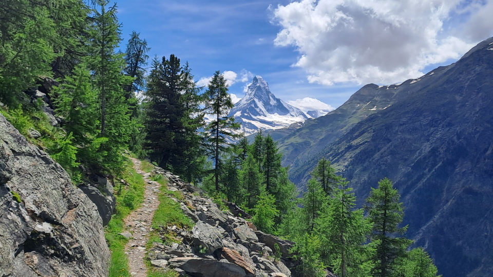
The Matterhorn (4,478m) from the Europaweg trail, which is the last stretch of the Walker's Haute Route
Walker's Haute Route
Scandinavia
Alpine Exploratory is delighted to cover both Norway and Sweden, of the five Scandinavian countries. We have marked down Iceland and its fabulous but harder-to-reach hills as next on our list, and then Finland with its bigger hills in the North, and we might never reach Denmark. Denmark is super, as we know from many visits over the years, but has flatter terrain and is perhaps less of an obvious destination for walking.
Norway Galdhøpiggen (2,469m)Where is Galdhøpiggen?
Galdhøpiggen is in the Jotunheimen mountain range in the North of the bulbous South of Norway.
A day trip?
Yes. Galdhøpiggen is a long, tough day's walk from Spiterstulen, itself a bus ride from the town of Lom.
(Photo: Snow slopes on Galdhøpiggen.)
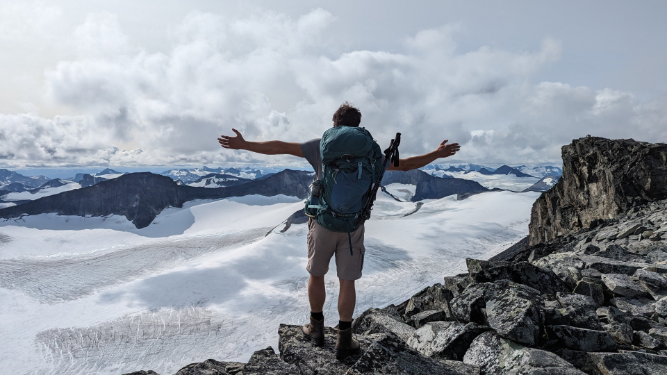
In command of the mountain majesty, on the ascent of Galdhøpiggen
Jotunheimen Tour
UK
The UK is of course made up of Scotland, Wales, England and Northern Ireland, to give them in the descending order of their highest points. Scotland's high point Ben Nevis is the high point of the UK. We don't yet run trips to Northern Ireland, but its highest point is Slieve Donard (850m) in the Mourne Mountains.
Scotland Ben Nevis (1,345m)Where is Ben Nevis?
Ben Nevis is next to Fort William, the touristy town on the West Coast of Scotland.
A day trip?
Yes. Take the bus from Fort William to the visitor centre and take the long path up Ben Nevis, firstly to the half-way tarn, and later steeply up rocky switchbacks.
(Photo: Ben Nevis above Glen Nevis.)
Wales Snowdon (Yr Wyddfa) (1,085m)Where is Snowdon?
Snowdon is in the mountain area known as Snowdonia, in the North West of Wales. Today, Snowdon is larely known by its Welsh name, Yr Wyddfa.
A day trip?
Yes. Snowdon is a day walk from several points around. From Llanberis, there is also a mountain train!
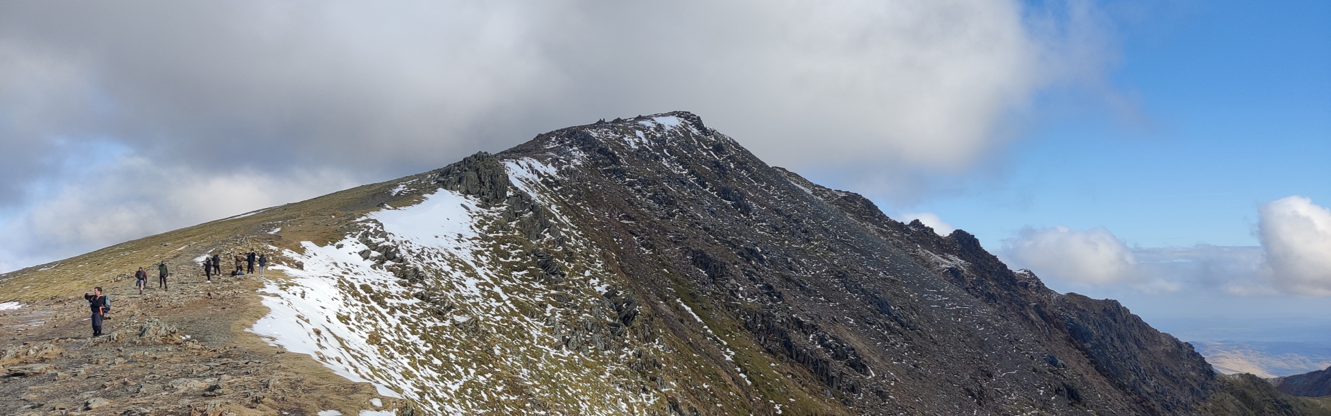
(Photo: Snowdon across Llyn Llydaw.)
EnglandScafell Pike (978m)Where is Scafell Pike?
Scafell Pike is the highest point in the Lake District, the beautiful hilly area in the North West of England.
A day trip?
Yes. Scafell Pike is walkable in a day hike from one of several points around. The summit is rocky, and often busy.
Alpine Exploratory runs a trip to Ireland, the Kerry Way, and by chance the high point of Ireland would be feasible in a separate day.
Ireland Carrauntoohil (1,039m)Where is Carrauntoohil?
Carrauntoohil is in the range known as MacGillycuddy's Reeks, a few miles outside Killarney, in Kerry in Ireland's South West.
A day trip?
Yes. Carrauntoohil would need a taxi to start, and to take you back, but would just be a day trip, initially on rolling moors.
(Photo: Carrauntoohil from below.)
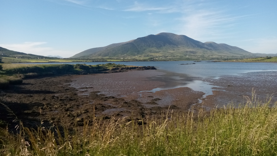
From Cahersiveen looking North East to the sea
Kerry Way
Thoughts about these mountains
About the UK
The mountains in the UK are at the bottom of our table, as is easily seen above, and to many might seem trivial. How can a mountain of only 1,345m (Ben Nevis) be difficult? To walkers used to the UK's weather and topography, however, these mountains certainly are frequently difficult and worthy of a lot of consideration. We would caution against seeing the UK's mountains as easily-done, and we would urge a good grounding before climbing them.
One factor that makes UK mountains harder than those in the Alps, relative to their height, is that paths in the UK are often harder to follow. The UK hills are generally clear of trees and in need of clear paths, but such paths have not yet established themselves, or been established, in clear ways. Simplistically, the Alps enjoy clearer routes through, because a cleared strip is very often a path, at least some path going somewhere.
About Scandinavia
Norway's Galdhøpiggen (2,624m) is the highest point in Scandinavia. The other countries are Iceland with Hvannadalshnjúkur (2,110m), Finland with the point on Halti (1,324m), Denmark with Møllehøj (171m), and of course Sweden with Kebnekaise (2,097m) as above, but none of these respective country high points are as high as Norway's.
Sweden's Kebnekaise (2,097m) is initially tempting because its elevation is not unduly great and because its climb is largely on normal rocky ground, as is Norway's Galdhøpiggen (2,624m). Kebnekaise can be done as a daywalk from the Kebnekaise hut which is a lovely place to stay in the far north of Sweden, itself a one-day hike in from the road head. However, Kebnekaise has a greater ascent that by itself puts it at the margins of a day's possibility, and tricky, technical ground to reach either of its two summits. Crampons are recommended for a snow ridge with a vast drop beneath.
What does it mean to be doable by ordinary mortals?
By this we mean that a walker could, wearing ordinary walking kit and without having learnt any of the skills of Alpinism (ropework, crevass technique, glacier travel or the use of ice axes and crampons) and without being practiced in scrambling or rock climbing, and without days or nights planned, just walk the day and do the peak.
`
Triglav (2,864m), the highest peak in Slovenia, is at the top of the peaks in this range of difficulty, and merits some further chat. The simplest route on Triglav climbs above the hut Dom Planika, steep and involved here on these slopes, and once on the ridge goes along it to a final summit slope. The scrambling is difficult throughout. Official advice is to go with Via Ferrata kit, which means a lanyard, to be able to attach to the metal cable beside much of the path, and a harness to attach the lanyard to yourself (and also a helmet); but with some shock absorption so that you can take a fall onto this system. In practice Triglav is often attempted without Via Ferrata kit, and this is achievable by fit walkers with scrambling experience.. and crucially if they get a nice day of weather.
Second on this list (of hills doable by ordinary mortals, in descending order of dificulty) would be the Zugspitze (2,962m) in Germany. With its short summit ridge, it is almost as hard a scramble as Triglav, but with simpler ground up to this point and therefore almost to the top. Or, to the bottom of the summit ridge, a mountain railway from Garmisch-Partenkirchen! Once at the top, take the cable car down into the Eibsee and then the (separate) train into Garmisch, a fabulous and not-too-long day.
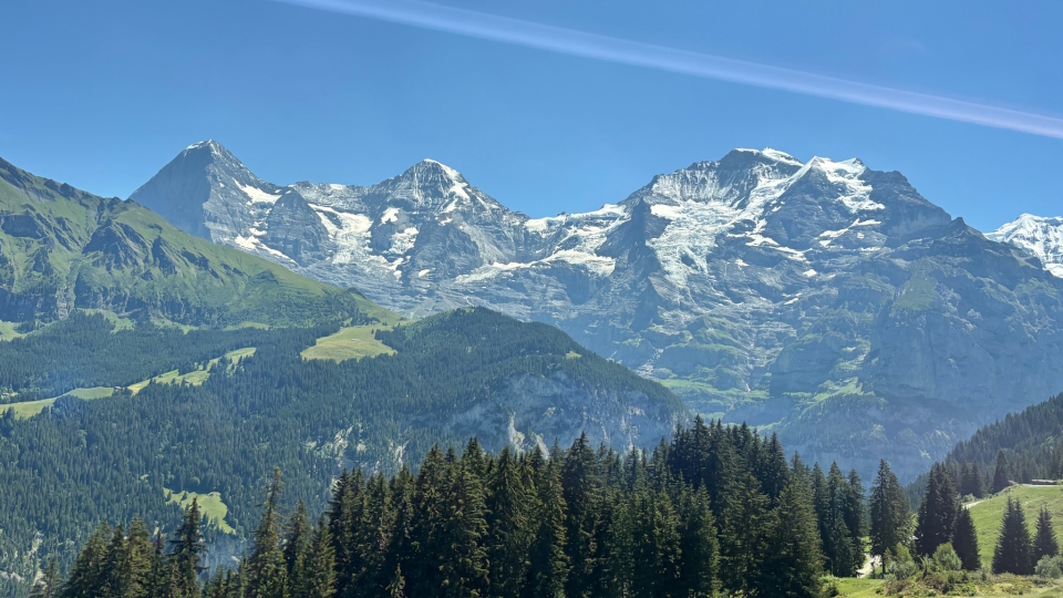
The classic view of the Eiger, Mönch and Jungfrau in Switzerland
Via Alpina
Comparisons to the United States of America
The lower 48 States
Mont Blanc (4,807m or 15,771ft) would be the highest peak in the lower 48 States (more formally the contiguous or conterminous United States, those states that are joined together, or in other words everywhere except Alaska and Hawaii).
The highest point in the lower 48 is of course Mount Whitney (4,421m or 14,505ft) in California. If it was a country in Europe, California would come in 4th below France, Italy and Switzerland.
Alaska's highest peak Denali (Mount McKinley) is 6,190m or 20,310ft and is therefore higher than anywhere in the Alps or Europe.
UK mountains, which sound low by international standards, would come in about half-way up a US table: Ben Nevis at 1,345m or 4,413ft is just higher than Vermont's high point Mount Mansfield at 1,340m or 4,395ft, the 26th state ranked by high point.
East of the Mississippi
Of those 26 states East of the Mississippi, eight rise higher than Ben Nevis (1,345m or 4,413ft):
Georgia at Brasstown Bald (1,458m or 4,784ft)
West Virginia at Spruce Knob (1,482m or 4,862ft)
Maine at Mount Katahdin (1,606m or 5,270ft)
New York State at Mount Marcy (1,628m or 5,343ft)
Virginia at Mount Rogers (1,740m or 5,711ft)
New Hampshire at Mount Washington (1,916m or 6,285ft)
Tennessee at Kuwohi (Clingmans Dome) (2,025m or 6,643ft)
North Carolina at Mount Mitchell (2,037m or 6,684ft)
Therefore, Mount Mitchell is the highest point in the US East of the Mississippi.
As can be imagined, a few other states East of the Mississippi have high points in ranges typical of UK mountains.
Puerto Rico and Great Britain
It is interesting that Puerto Rico, a territory of the US, comes immediately below Great Britain in a table of the world's islands ranked by highest point. The high point of Puerto Rico, Cerro de Punta (1,338m or 4,390ft), is just 7m lower than Ben Nevis (1,345m or 4,413ft) in Great Britain.
Comparisons by land area
Switzerland, to take an instance of a European country in the heart of the Alps, has a total land area of 15,943 square miles. By comparison, the state of Texas, which is the biggest state other than Alaska, is 268,596 square miles.
Switzerland is slightly bigger than Maryland (12,406 square miles), the 42nd of the 50 states by land area. Rhode Island, the smallest state, is 1,545 square miles, and Alaska, the biggest state, is 665,384 square miles.
Please chat with us
Please chat with us at info@alpineexploratory.com about these peaks, as you plan your trip. We'd love to help.
Thank you.
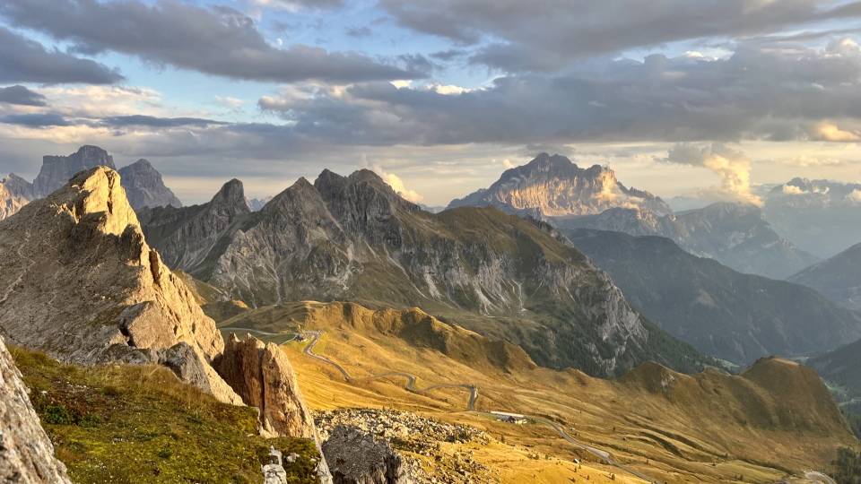
Looking South to the Monte Pelmo and Monte Civetta massifs, from Rifugio Nuvolau in the Dolomites of Italy
Alta Via 1
Alpine Exploratory
Alpine Exploratory is a system of knowledge on the best mountain trekking in our areas, giving clients superb holidays based on this exploration.
 02 8319 2266 from Australia
 416-628-3473 from Canada
 04 889 4515 from New Zealand
 646-757-1102 from the USA




 Norway
 Scotland
 Wales
Wales
 Ireland
 England
 Alps
Alps
 France Mont Blanc (4,806m)
 Italy Monte Bianco (4,806m)
 Switzerland Dufourspitze (Monte Rosa) (4,634m)
 Austria Großglockner (3,798m)
 Germany Zugspitze (2,962m)
 Slovenia Triglav (2,864m)
 Liechtenstein Grauspitz (2,599m)
 The Matterhorn (4,478m) from the Europaweg trail, which is the last stretch of the Walker's Haute Route



 Alpine Exploratory


